![]()
This page catalogues the evolution of SMS—and incidentally the evolution of mapping technology. From a 1934 map surveyed by an SMS alumna to relatively basic maps from the 1990s to current satellite views.
Click on the thumbnails for full size images.
| Map of the school area created by late W E G J Watson (Class of 1927), apparently a qualified Ordnance Surveyor, in 1934, based on his surveys of 1928. Note that at the time it was Abu High School (AHS). Aloysius D'Souza's (1951) daughter Deepika happened to meet Watson's sister (since deceased) in Cambridge UK in 1996, and picked this up. The original map covers the area from Dilwara Road (near Toll Bar) to pretty close to Shallow Bay. This is a small extract. | 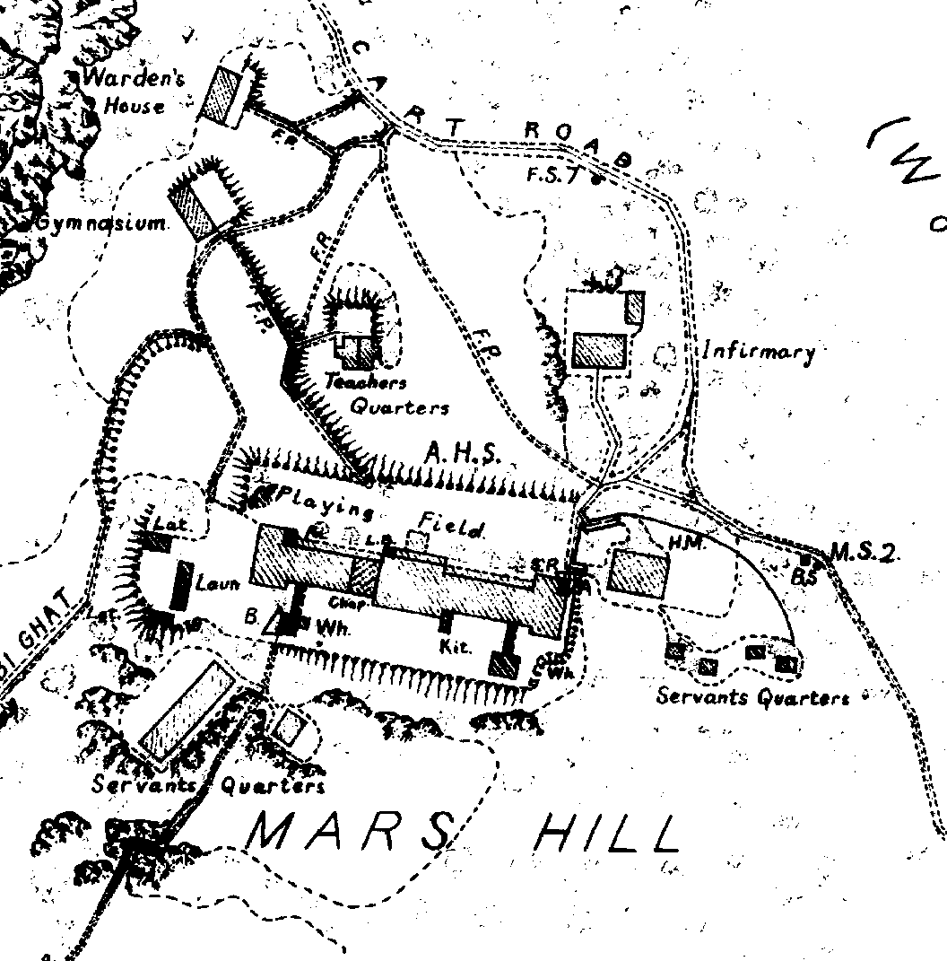 |
| With apologies to Mr Watson, an update. Move your mouse cursor over the newer structures; some link to photos. |  |
| Larger section of Watson's map, from Big Pitch in the southwest to Paddy's Bridge at north centre, with the colour update superimposed. | 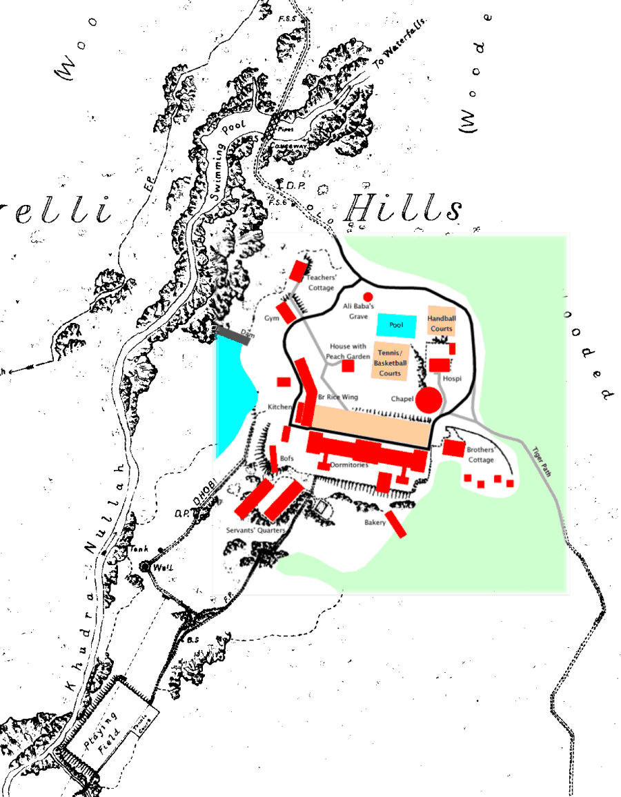 |
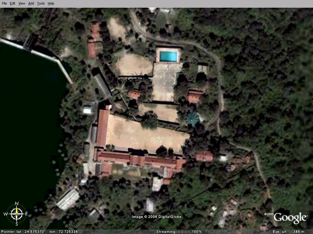
| Aerial photograph of the SMS campus, taken in 1984 by Capt Fernandes (father of Bruce) from an IAF copter. |  |
| SMS campus from space. As we come full circle
with technology, it's useful to compare this with Watson's (1927) hand
drawn
map above and to appreciate how darn accurate it was. More space shots
below. |
 |
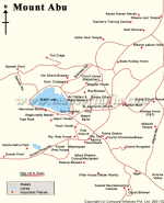
| Mount Abu, from mapsofindia.com (links to their original) |
 |
| Generated at the ESRI web site, probably based on the GTOPO30 digital elevation models from EROS data centre. The red dot is Abu, and Abu Road lies in the little dip to the east of that range — the railway track appears in the maps below. | 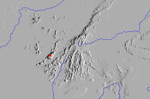 |
| Can't remember where this came from ... maybe NASA's index to the Apollo and space shuttle pictures. If you were wondering where Sirohi was ... | 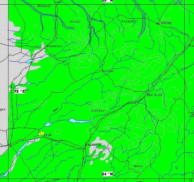 |
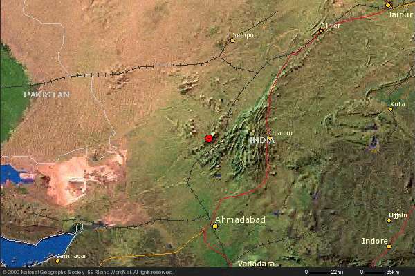
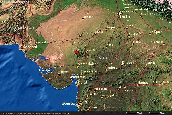
| Southern Rajasthan from Ahmedabad to Jaipur. This and the one below were generated at the National Geographic web site, combining WorldSat satellite imagery, the Digital Chart of the World, GTOPO30 (suspected), and ESRI web mapping software. |
 |
| Western India from Bombay to Delhi. Beautiful job on the continental shelf and the Afghan ranges. |
 |
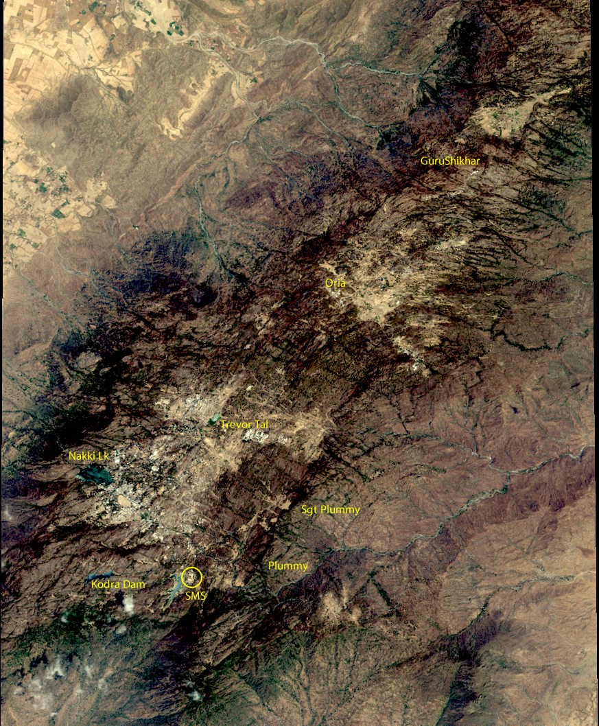
| The first relatively detailed shots publicly
available in 2006, from Space
Imaging (now GeoEye). Some popular haunts are
annotated in. Future astronauts: your assignment on Day One is to
locate this scene. Shots below are from DigitalGlobe, with TerraMetrics elevation, distributed by Google Earth. |
 |
| Looking from school towards town |
 |
| Looking east from near school (right
foreground) at Plummy. |
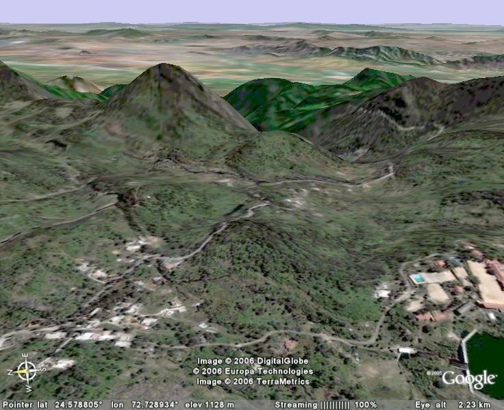 |
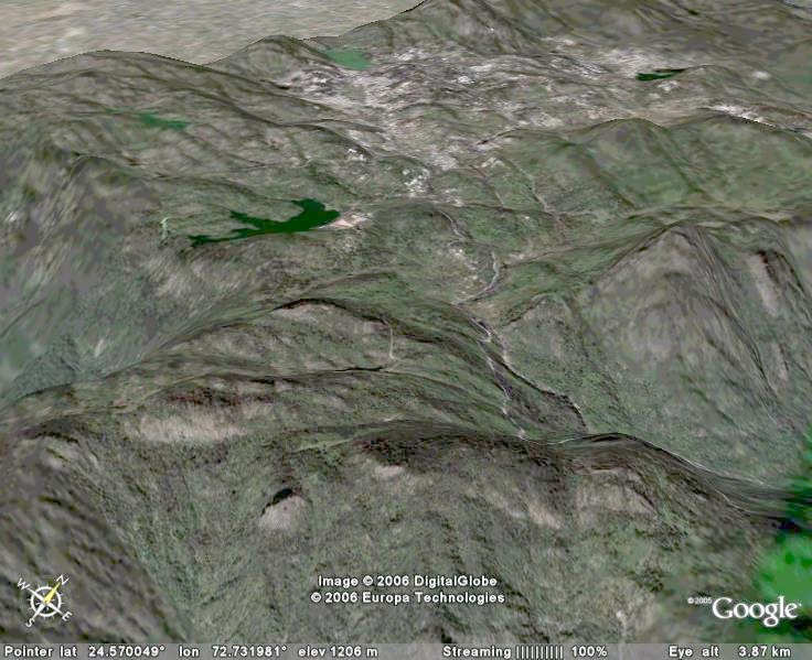
| Looking west from 2 km above Golden Horn (a
sharpish rock in the foreground, slightly left of centre). SMS is
in the mid
distance on the left, and town is beyond. |
 |
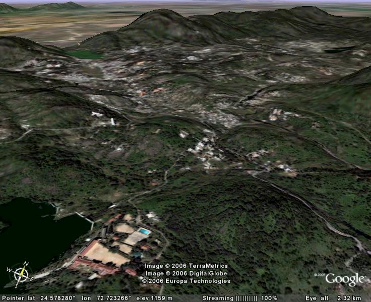
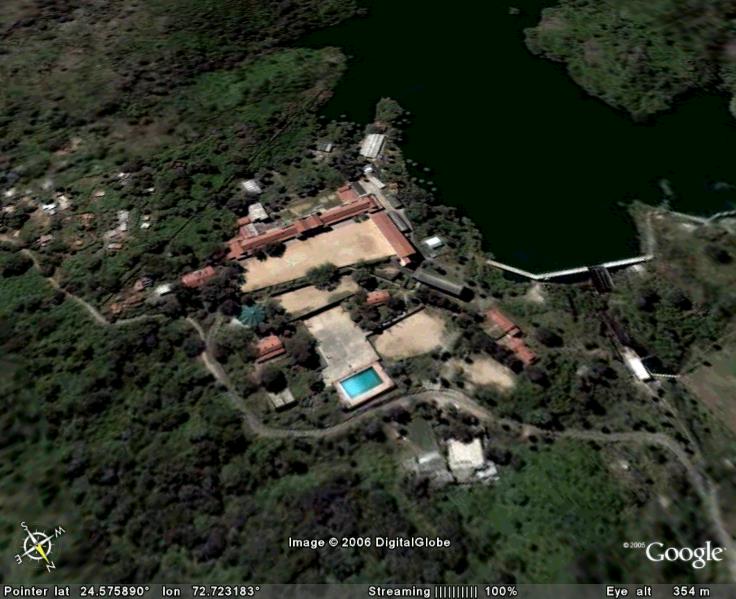
| School campus and surrounds. |
 |